STAY ON TRACK THROUGH ALL KINDS OF ADVENTURES
With routable mapping for roads and trails, the Montana 710 handheld brings advanced outdoor features into a sturdy 5-inch format that’s ideal for navigation on foot, bike, kayak, ATV and more.
RUGGED BY DESIGN
This durable, water-resistant handheld is tested to meet MIL-STD 810 for thermal, shock, water and vibration. It features a glove-friendly 5-inch touchscreen and is compatible with a variety of robust mounting solutions (sold separately) to best suit your activities.
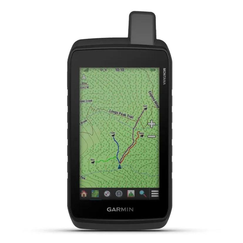
TOPOACTIVE MAPS
To navigate your adventures, use preloaded topographical maps. View terrain contours, elevations, coastlines, rivers, landmarks and more.
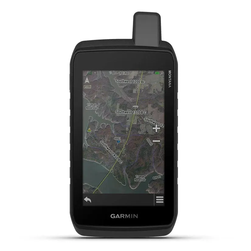
SATELLITE VIEWS
Access subscription-free, high-resolution satellite imagery with direct-to-device downloads over Wi-Fi® connectivity. See photorealistic overhead views of routes and surrounding terrain, and easily create waypoints based on landmarks.
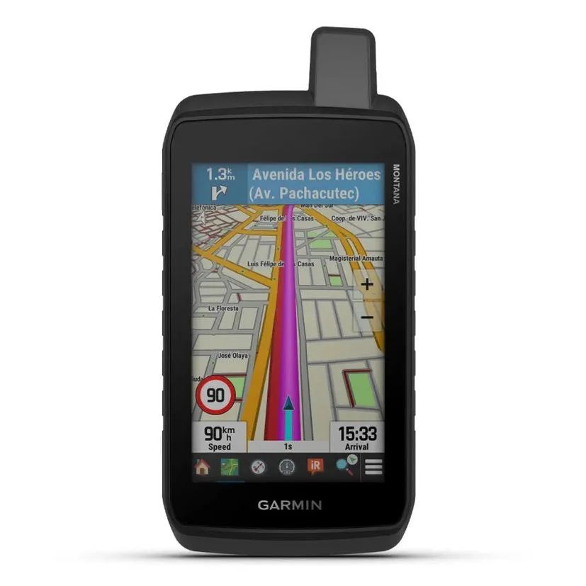
ADDITIONAL MAPS
With 32 GB of onboard memory, you can download even more maps, such as City Navigator® maps for your drive or BlueChart® g3 charts for the water (sold separately).
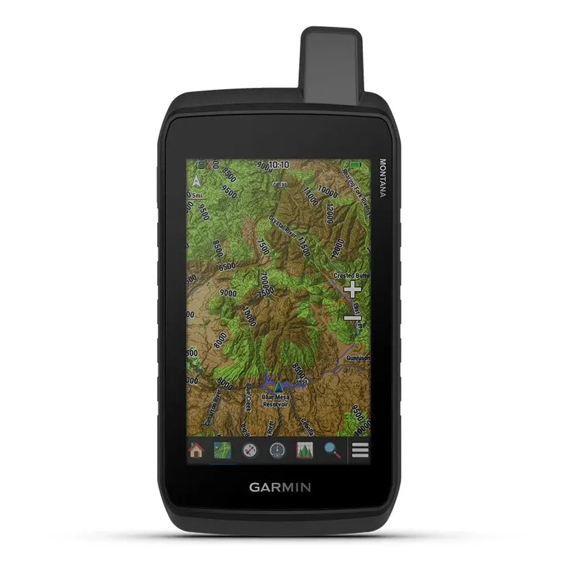
OUTDOOR MAPS
Add a subscription to Outdoor Maps (sold separately), and get ongoing access to a wide variety of premium mapping content and regular updates sent right to your Garmin device via Wi-Fi technology.
GARMIN EXPLORE™ APP
Pair with the Garmin Explore App to plan and review trip data, plus manage your waypoints, courses and activities.


")


![Toadfish Waterproof Backpack Sling - Ocean Blue [2203]](https://www.coolback.shop/image/toadfish-waterproof-backpack-sling-ocean-blue-2203_psj6Ll_300x.webp "Toadfish Waterproof Backpack Sling - Ocean Blue [2203]")

